



Maverick
GPS Navigation

Descrizione di Maverick: GPS Navigation
Use offline maps and GPS even without an internet connection. This app is great for hiking, boating, geocaching and other outdoor activities.
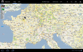
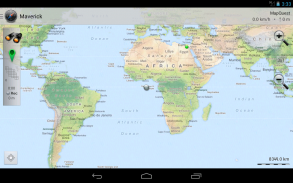
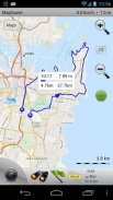
• Multiple global and regional online maps, including: Bing, Yandex, Open Street Maps, OSM Cycle, OSM Public Transport, Multimap (UK), OutdoorActive (Germany, Austria, South Tyrol), Cykloatlas, HikeBikeMap (Germany), Open Piste Map, NearMap (Australia) and many other maps.
All maps automatically cached for offline use. Use Mobile Atlas Creator to download maps or MAPC2MAPC to convert maps from other formats.
• Share your current or planned position
You can send address, GPS coordinates, link to Google Maps and even map image.
• Navigate easily
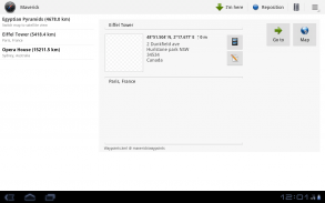
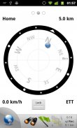
Build-in radar shows the direction, distance and estimated time to a point of interest.
• Save places you visit
All waypoint stored in KML file and can be viewed and edited in Google Earth.
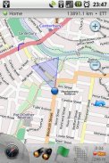
• Record tracks with single tap
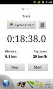
Tracks are recorded in GPX format and can be viewed in Google Earth and other software.
• Upload tracks to GPSies
Free account is required for uploading.
• Trip Computer
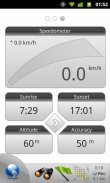
Watch speed, altitude, pitch and many other values.
Only in Pro version:
• Unlimited waypoints and tracks
• Lock compass to bearing
• UTM and OSGB grids
• OS Explorer maps
• FourSquare support
We can implement standard Google MapView, but it's limited - no caching and terrain view. If you need it, please email us or leave a comment.
</div> <div jsname="WJz9Hc" style="display:none">Utilizzare mappe e GPS offline anche senza una connessione internet. Questa applicazione è ideale per escursioni a piedi, gite in barca, geocaching e altre attività all'aperto.
• Più mappe online globali e regionali, tra cui: Bing, Yandex, Open mappe stradali, OSM Cycle, OSM Trasporto pubblico, Multimap (Regno Unito), OutdoorActive (Germania, Austria, Alto Adige), Cykloatlas, HikeBikeMap (Germania), Open Mappa Pista , NearMap (Australia) e molte altre mappe.
Tutte le mappe nella cache automaticamente per l'utilizzo offline. Utilizzare Mobile Atlas Creator per scaricare mappe o MAPC2MAPC per convertire le mappe da altri formati.
• Condividi la tua posizione attuale o prevista
È possibile inviare l'indirizzo, le coordinate GPS, collegamento a Google Maps e perfino mappa immagine.
• Navigate facilmente
Radar Costruire-in mostra la direzione, la distanza e il tempo stimato per un punto di interesse.
• Salvare i luoghi visitati
Tutti i waypoint memorizzati in file KML e possono essere visualizzati e modificati in Google Earth.
• Le tracce di registrazione con gli semplice tocco
I brani vengono registrati in formato GPX e possono essere visualizzate in Google Earth e altri software.
• Carica tracce GPSies
Conto gratuito è necessaria per il caricamento.
• Computer di viaggio
Guarda velocità, altitudine, pece e molti altri valori.
Solo nella versione Pro:
• waypoint e tracce illimitati
• bussola Lock cuscinetto
• UTM e OSGB griglie
• Mappe OS Explorer
• Supporto Foursquare
Siamo in grado di implementare standard di Google MapView, ma è limitato - nessun caching e di terreno vista. Se ne avete bisogno, contattateci via email o lasciare un commento.</div> <div class="show-more-end">


